River Kaveri (Kannada: ಕಾವೇರಿ
ನದಿ; Tamil: காவேரி ஆறு) one of the holiest rivers of South India. It
is the main source of irrigation for millions of hectares of agricultural land
of the region which also provides drinking water to entire Bangalore and Mysore
and helps generating hydro-power. The
sugarcane fields of Mandya region and paddy fields of Nagapatnam and Tiruvarur are
fed by the irrigation canals of Kaveri. Shivanasamudra is the second Hydro-electric
Power stations in Asia, first one being Sidrapong Hydel Power Station in
Darjeeling.
Talakaveri, a peak in the Western Ghats in Kodagu (Coorg / Madikeri) in Karnataka, is the birth place of Kaveri.
Talakaveri, the birthplace of River Kaveri
 |
| The Brahmagiri Ranges |
 |
| Talakaveri |
 |
| Bhagamandala, Sri Bhagandeshwara temple |
Bhagamandala Triveni Sangama, where Kaveri is joined by two other rivers
 |
| Bhagamandala |
The river flows eastward
through Karnataka and Tamil Nadu before entering the Bay of Bengal.
The Kaveri basin is estimated to be 81,155 km2 and
its length is estimated to be around 800Kms. Its tributaries include Harangi, Lakshmana
Tirtha, Hemavati, Shimsha, Kabini, Arkavati, Bhavani, Lokapavani, Noyyal and
the Amaravati River.
Dubare is a forest in Madikeri and there is an elephant training camp on the banks of Kaveri
 |
| Elephant feeding at Dubare Elephant Camp |
kaveri Nisarga Dhama, near Kushalnagar is an island formed by Kaveri where KTDC runs a hotel offering stay in thatched cottages in the midst of creepy forest.
 |
| Nisargadhama - Scenic island formed by Kaveri |


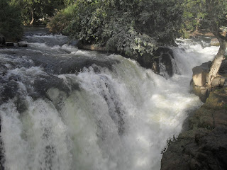
Chunchanakatte is a place where the river loses it elevation
considerably. Here Kaveri descends down step by step over the rocks making
enormous sound. Sri Rama temple is built on the right bank of this river. Notable
thing about this temple is that the deafening sound of Kaveri jumping down the
rocks fails to make entry inside the temple.
Chunchanakatte Falls
 |
| Chunchanakatte Falls |
 |
| Chunchanakatte Sri Rama Temple |
Krishna Raja Sagar Anikut (KRS Dam) is a beautiful dam created in Mysore, where River Hemavathi from Hassan joins Kaveri.Downstream from KRS, an island is created at Shrirangapatna, the capital of Tipu Sultan, which is considered as historically and religiously very important. There are three Ranganatha Swamy temples on the banks of Kaveri which are considered most sacred. In Shrirangapatna, the first temple among them, is called Adi Ranga. The second is in Shivanasamudra, called Madhya Ranga. Tha Anthya Ranga is the famous Sriranga Temple of Thiruchirapalli in Tamil Nadu.
The Krishna Raja Sagar Dam also known as Kannambadi Anekattu, built by Sir M Vishweshwaraiah during Mysore Vodeyar era.
 |
| Majestic Krishna Raja Sagar Dam |
 |
| The Balamuri Falls downstream of KRS |
The under-restoration Hosa Kannambadi Sri venugopalaswamy Temple on the left banks of KRS. This temple was submerged in the dam and was lying submerged since then, reappearing whenever water level in the dam decreases considerably. During 2012, transportation of this temple to Hosa Kannambadi nearby was taken up.
 |
| Sri Venugopalaswamy Temple of Hosa Kannambadi |
 |
| KRS seen from Venugopalaswamy Temple of Hosa Kannambadi |
The Musical Fountains in Brindavan Gardens, KRS, Mysore
 |
| Dance of the Waters - Brindavan Gardens, KRS, Mysore |
The island of Shrirangapatna formed by Kaveri
 |
| Sangama - Pashchima and Purva Vahini of Kaveri |
 |
| The bathing stand of Sri Gosai Ghat |
 |
| The ancient canal system at Karighatta Hills, near Srirangapatna. Kaveri can be seen at a distance |
 |
| Dungeons of Tipu Sultan |
 |
| Sri Ranganatha Swamy of Shrirangapatna |
Sosale Shri Rama Temple, Tirumakudlu Narasipura (T Narasipura). Here, River Kabini joins Kaveri, there are several temples and mutts making it one of the important pilgrimage center.
 |
| T Narasipur where Kabini joins Kaveri - land of temples |
Kaveri flowing through Muthathi Forest
 |
| Muthathi - songs and dances of a divine river |
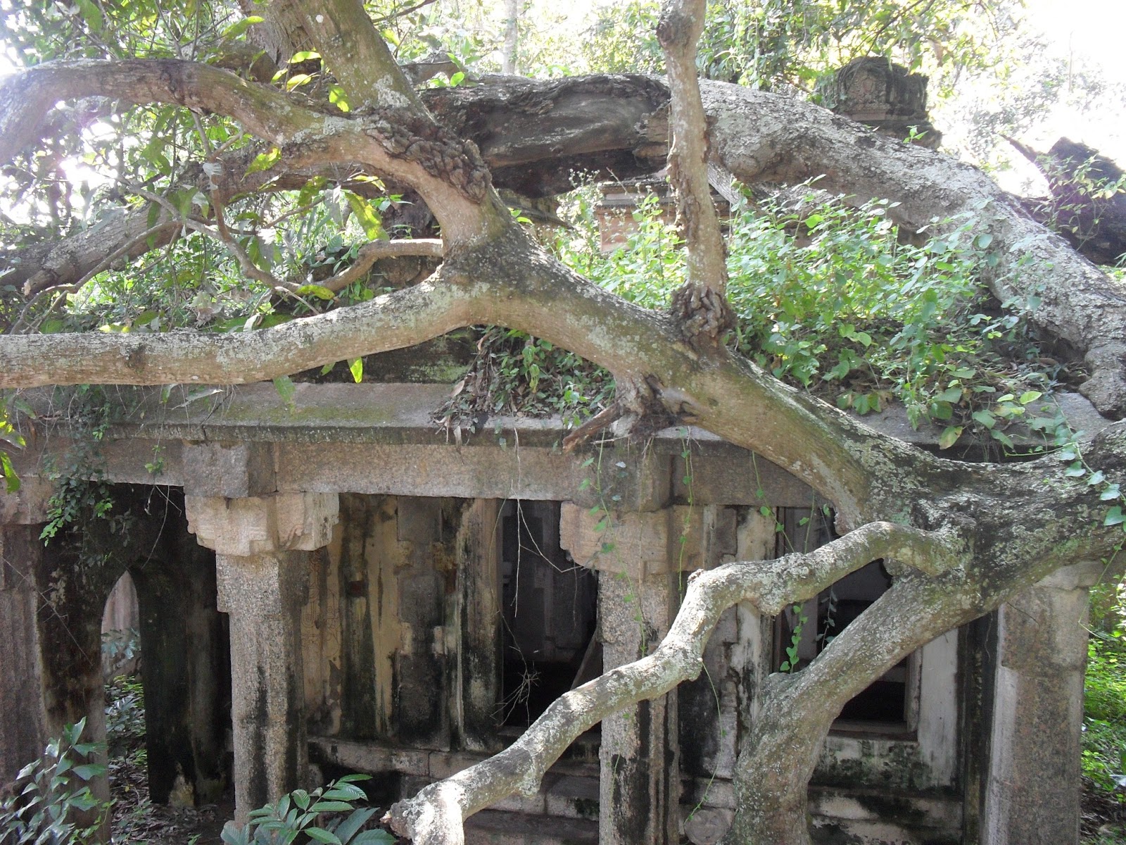
At Somanathapura Kaveri touches the feet of Lord Chenna Keshava built by Soma a Hoysala Commander. The temple was in dilapidated state and till then ASI was sleeping. Of late, they have taken up the restoration work but, the glory once lost is lost forever. The intricate design and exquisite carvings both inside and outside of the temple are unparalleled.
Somanathpura Keshava Temple built by Mummadi Narasimha of Hoysala dynasty in AD 1268.
 |
| Somnathpura - an unbelievable 'Picture Poem' |
There after the river flows down to Talakad, a very important place historically. Talakad once looked like a ghost town buried under the sand. It was believed that there were more than 30 temples buried, not being able to withstand the course of Kaveri. Excavations are still underway, where Kaveri once flown over these temples.
Talakadu - a history buried under sands of Kaveri
In the island of Shivanasamudra, a picturesque bluff is constructed to feed for the power generation unit. There are two waterfalls on either side of Shivanasamudra Island that descend about 300ft. They are the spectacular Gaganachukki and Bharachukki falls which are very nearer to each other. Nisargadhama (near Kushalnagar), Hotel Mayura (in Shrirangapatna), Doddamakali Fishing Camp, Bhimeshwari Fishing Camp (both in Muthathi forest) and Galibore Fishing Camp (near Mekedatu) are the Karnataka govt owned picnic spots dotted along the course of Kaveri.
 |
| The Shivanasamudra Bluff |
 |
| Gaganachukki Falls |
 |
| Bharachukki Falls |
Near Kanakapura, River Arkavathy joins Kaveri creating the
holy place called Sangama. Around 4Kms downstream, at Mekedatu (goat’s leap), Kaveri
flows through a very narrow and dangerously deep gorge. The place is called so
because the gorge is so narrow that a goat can cross the river. As of now, the
cleft is too wide for a goat to leap across, may be due to the erosion caused
by continuous flow of water over the years.
 |
| Arkavathi and Kaveri Sangama, Kanakpura |
 |
Mekedatu (goat's leap)
|
Dabbagauli is the lesser known picnic spot, last one in Karnataka
along the course.
Here after, the Kaveri enters Tamilnadu and in Biligundlu,
her resource is measured in accordance with the water sharing pact between two
states. Hogenakal near Dharmapuri, is
some 5Kms away from here, which is called as “Niagara of India”. The
carbonatite rocks, the gorge, the river and the waterfall spread across vast
expanse of Hogenakkal makes it a unique waterfall in India.
 |
| Hogenakal Falls near Dharmapuri |
Flowing ahead the
river enters Mettur dam, a main source of drinking and irrigation in Tamilnadu.
It then runs through Erode (where River Bhavani joins), Karur (Tirumakudal –
where Amaravathi joins), Thiruchirapally (where Srirangam River Island is
created and Lord Sriranga is situated). Some 20Kms ahead, A long irrigation dam
is built to divert the entire water of Kaveri into canals. It was built by the
Chola king Karikalan and is considered to be one of the oldest (more than 2000
years old) in the world, still in use. The channel thus diverted passes through
Thanjavur and Kumbhakonam before emptying into the sea at Poompuhar. The actual
place where Kaveri enters the Bay of Bengal is somewhere near Pichavaram even
though the waters made to flow into different canals and enter the sea at different
places, mainly Poompuhar.


No comments:
Post a Comment